

For full-sized map, incl. all tram lines, click here!
METRO
Paris, the capital of France (9 million inhabitants in Greater Paris), is one of Europe's metro flagships. After London (1863), Glasgow and Budapest (both 1896) this is the continent's fourth oldest metro system and probably the densest.
Lines: History & Projects
The first line (ligne 1) was opened in 1900 as part of a planned six line network. In 2007 Paris has 14 Métro lines and 2 branches (see full map here) that are operated as separate lines. The total length of the network is 216.3 km (169.5 km within Paris):L1 | L2 | L3 | L4 | L5 | L6 | L7 | L8 | L9 | L10 | L11 | L12 | L13 | L14

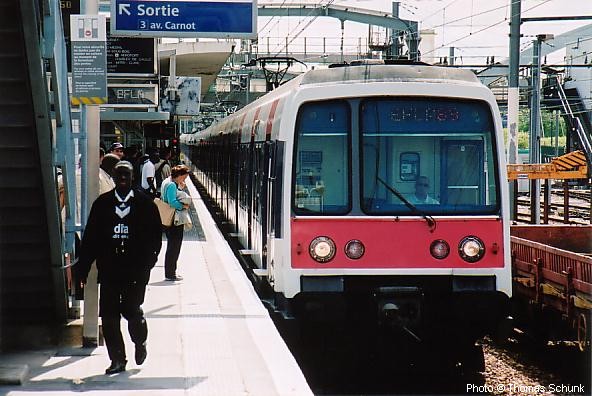
16.5 km - 25 stations; almost entirely underground except for Bastille station and the Seine bridge between Pont de Neuilly and Esplanade de la Défense. After platform screen doors and a new operating system (Siemens Trainguard MT CBTC) have been installed, the first driverless trains started running on Line 1 on 3 Nov 2011. By early 2013, once all trains on this line had been replaced with new MP05 stock, full driverless operation with headways of only 85 seconds was introduced.
19/07/1900: Porte de Vincennes - Port Maillot (8 stations of 18, the rest were opened between 06/08/1900 and 01/09/1900)
03/1934: Porte de Vincennes - Château de Vincennes
04/1937: Port Maillot (new station) - Pont de Neuilly
04/1992: Pont de Neuilly - Grande Arche de La Défense
More Line 1 photos
Extension Project Website

(northern ring line, until 14/10/1907 called ligne 2 Nord)
(12 km):
13/12/1900: Porte Dauphine – Charles de Gaulle Etoile
10/1902: Charles de Gaulle Etoile – Anvers
31/01/1903: Anvers – Rue de Bagnolet (since 1970 Alexandre Dumas)
02/04/1903: Rue de Bagnolet (Alexandre Dumas) – Nation
More Line 2 photos


(12 km):
10/10/1904: Père Lachaise - Villiers
01/1905 Père Lachaise - Gambetta
05/1910: Villiers - Péreire
02/1911: Péreire - Pte. Champerret
09/1937: Pte. Champerret - Pont de Levallois/Bécon
02/04/1971: Gambetta - Gallieni
More Line 3 photos


(1.3 km):
27/11/1921: Gambetta - Porte des Lilas (originally part of line 3, since 1971 separate)
More Line 3b photos


(11.3 km):
21/04/1908: Porte de Clignancourt – Châtelet
30/10/1909: Porte d'Orleans – Raspail
09/01/1910 Châtelet - Raspail 23/03/2013: Porte d'Orleans - Mairie de Montrouge (0.8 km)
Les Halles station reconstructed and reopened on 03/10/1977 with new RER station.
After the first section of the southern extension from Porte d'Orléans to Mairie de Montrouge was brought into service in March 2013, line 4 will be extended further south, 2014-2019, with two stations, Verdun-Sud and Bagneux (1.9 km).
Montrouge extension: Project blog | Bagneux extension: Project Website
More Line 4 photos


(14.5 km):
02/06/1906: Place d'Italie – Gare d’Orléans (now Gare d’Austerlitz)
07/1906: Gare d’Austerlitz - Place Mazas (now Quai de la Rapée)
12/1906: Quai de la Rapée - Lancry (now Jacques Bonsergent)
15/11/1907: Jacques Bonsergent - Gare du Nord
10/1942: Gare du Nord - Église de Pantin
25/04/1985: Église de Pantin - Bobigny/Pablo Picasso
More Line 5 photos


(southern ring line) (13.5 km), until 14/10/1907 called ligne 2 Sud; then until 1942 Étoile - Pl. d'Italie section was a part of line 5; Pl. d’Italie – Nation was a ligne 6:
02/10/1900: Étoile - Trocadéro
11/1903: Trocadéro - Passy
04/1906: Passy - Place d'Italie
03/1909: Place d'Italie - Nation
At Étoile - Charles de Gaulle trains reverse in a loop, there is also such a loop at Nation which is only used during rush hours.
More Line 6 photos


(22.5 km)
05/11/1910: Porte de la Villette – Opéra
07/1916: Opéra - Palais Royal
04/1926: Palais Royal - Pont-Marie
02/1930: (Odéon (L10) -) Place Monge – Place d’Italie
03/1930: Place d’Italie - Porte de Choisy
06/1930: Pont-Marie - Pont Sully (now Sully Morland)
26/04/1931: Sully Morland - Place Monge - Porte d'Ivry
01/05/1945 Porte d'Ivry - Mairie d'Ivry
10/1979 Porte de la Villette - Fort d'Aubervilliers
12/1982: Maison Blanche - Le Kremlin-Bicêtre
02/1985: Le Kremlin-Bicêtre - Villejuif-Louis Aragon
06/05/1987: Fort d'Aubervilliers - La Courneuve
Pierre Curie station renamed Pierre et Marie Curie on 8 Mar 2007.
More Line 7 photos


(3 km):
18/01/1911: Pré-St.Gervais - Louis Blanc (line 7 branch, separate line since 1967)
More Line 7b photos


(23.3 km):
13/07/1913: (Charles Michels on today's Line 10) - La Motte Picquet Grenelle - Opéra
06/1928: Opéra - Richelieu-Drouot
05/1931: Richelieu-Drouot - Porte de Charenton
07/1937: La Motte Picquet Grenelle - Balard
10/1942: Porte de Charenton - Charenton-Écoles
09/1970: Charenton-Écoles – Maisons-Alfort Stade
04/1972: Maisons-Alfort Stade - Maisons-Alfort Les Juilliottes
09/1973: Maisons-Alfort Les Juilliottes - Créteil-l’Échat
10/09/1974: Créteil-l’Échat - Créteil-Préfecture08/10/2011: Créteil-Préfecture - Créteil-Pointe du Lac
At Commerce platforms are not opposite each other, but staggered.
More Line 8 photos


(20 km):
08/11/1922: Exelmans - Trocadéro
05/1923: Trocadéro - Saint-Augustin
06/1923: Saint-Augustin - Chaussée d'Antin
09/1923: Exelmans – Porte de Saint-Cloud
06/1928: Chaussée d'Antin - Richelieu-Drouot
12/1933: Richelieu-Drouot - Porte de Montreuil
02/1934: Porte de Saint-Cloud - Pont de Sèvres
10/1937: Porte de Montreuil - Mairie de Montreuil
More Line 9 photos


(12 km):
13/07/1913: La Motte Picquet Grenelle – Beaugrenelle (now Charles Michels) (as a branch of Ligne 8)
09/1913: Charles Michels - Porte d'Auteuil
12/1923: (Invalides - Duroc) - Croix Rouge (closed after WWII)
03/1925: Duroc - Mabillon
02/1926: Mabillon - Odéon
02/1930: Odéon - Maubert Mutualité (- Pl. d’Italie, from Place de Monge using the tracks of today's Ligne 7);
04/1931: Maubert Mutualité - Jussieu
07/1937: La Motte Picquet Grenelle - Duroc
07/1939: Jussieu - Gare d'Austerlitz
10/1980: Porte d'Auteuil - Boulogne Jean Jaurès
02/10/1981: Boulogne Jean Jaurès - Boulogne Pont de St.Cloud
More Line 10 photos


(6.5 km):
28/04/1935: Châtelet – Porte des Lilas
17/02/1937: Porte des Lilas - Mairie des Lilas
Line 11 will be extended from Mairie des Lilas to Rosny-Bois-Perrier via Noisy-le-Sec and Romainville (6 stations, one of which elevated). Construction 2015 - 2020. [Project Website] In a later stage, another extension, part of the Grand Paris project, will follow from Rosny-Bois Perrier to Noisy - Champ where it will meet the future lines 15 and 16.
More Line 11 photos


(15.2 km):
05/11/1910: Porte de Versailles – Notre-Dame-de-Lorette
04/1911: Notre-Dame-de-Lorette - Pigalle
10/1912: Pigalle - Jules-Joffrin
08/1916: Jules-Joffrin - Porte de la Chapelle
24/03/1934: Porte de Versailles - Mairie d'Issy
18/12/2012: Porte de la Chapelle - Aubervilliers Front Populaire Line 12 is being extended further north from Aubervilliers Front Populaire to Mairie d'Aubervilliers via Aimé Césaire (2 km, 2017).
Project Website
More Line 12 photos


(23 km):
26/02/1911: Saint-Lazare - Porte de Saint-Ouen
01/1912: La Fourche - Porte de Clichy
12/1923 Invalides - Duroc (formerly a part of a line 10; then line 14)
01/1937: Montparnasse-Bienvenüe - Porte de Vanves
07/1937: Montparnasse-Bienvenüe - Duroc
06/1952: Porte de Saint-Ouen - Carrefour Pleyel
06/1973: Saint-Lazare - Miromesnil
02/1975: Miromesnil - Champs-Elysées Clémenceau
05/1976: Carrefour Pleyel - Saint-Denis-Basilique
11/1976: Champs-Elysées Clémenceau - Invalides (connection with ex-line 14) and Porte de Vanves - Châtillon-Montrouge
05/1980: Porte de Clichy - Gabriel Péri
25/05/1998: Saint-Denis-Basilique - Saint-Denis Université14/06/2008: Gabriel Péri - Asnières-Gennevilliers Les Courtilles (1.9 km)
At Liège platforms are not opposite each other, and at La Fourche the trains coming from St.Denis stop on the lower level.
More Line 13 photos
Line 13 was planned to be further extended from Asnières-Gennevilliers Les Courtilles to Port de Gennevilliers.


(9 km)
Finally in the 1990's Paris started to build a new metro line, the so-called METEOR (Métro Est Ouest Rapide) although from the day of inauguration (15/Oct/1998) it is called ligne 14. This line is meant to alleviate ligne 1 and RER ligne A in the central area and starts at Maison Blanche in the south, then runs parallel to ligne 1 and A between Gare de Lyon and Châtelet-les Halles and finally turns north to St. Lazare from where it will be connected to the western branch (Gabriel Péri) of ligne 13. After some years of delay the first stretch from Bibliothèque F. Mitterrand (planned as Tolbiac-Masséna) to Madeleine was finally opened in October 1998. In summer 1998 construction work for the second section to St. Lazare started, which was finished in Dec. 2003. In autumn 2000, construction of a small workshop began, which was necessary to rebuild the original workshop into Olympiades station that was finally completed in June 2007.
15/10/1998: Madeleine - Bibliothèque François Mitterrand
16/12/2003: Madeleine - Saint-Lazare26/06/2007: Bibliothèque François Mitterrand - Olympiades
More Line 14 photos
Initially planned to be extended north to Place de Clichy and La Fourche and connected to one of the northern branches of ligne 13, ligne 14 will now be extended to Mairie de Saint-Ouen (RER C) via Porte de Clichy (Ligne 13). More details here
Initially planned to be extended south to Maison Blanche, M7, with a connection to the Villejuif branch of line 7, it is now planned to be extended south to Orly Airport on a new, more westerly route as part of the Nouveau Grand Paris network (which includes lines 15-18, see below).
Other Metro Projects
Besides the extensions planned to existing lines (notably, lines 4, 11, 12 and 14), the Grand Paris Express network is planned, a system of circular and tangential metro lines around Paris proper:
Line 15 - a sort of orbital line with a handle in the east, with the first section between Pont de Sèvres (M9) to Noisy Champs to be built first by 2020. Later, a western extension will continue to La Défense an the new hub at Saint-Denis Pleyel near the current RER station on line D. The eastern leg of this line will parallel the existing RER E route between Rosny-Bois-Perrier and Nogent Le Perreux and terminate at Champigny, where interchange would be available to the initial section of line 15.
Line 16 - from Saint-Denis Pleyel to Noisy Champs via Sevran Beaudottes and Sevran Livry, both on RER line B. (Project Website)
Line 17 - will also start at Saint-Denis Pleyel and share tracks with line 16 up to Le Bourget before heading northeast towards Charles-de-Gaulle Airport and eventually to Le Mesnil Amelot.
Line 18 - less defined, it would serve the southwestern outskirts between Versailles and Orly.
Details and progress of all these projects can be found on the STIF website and also at Societé du Grand Paris!
RER
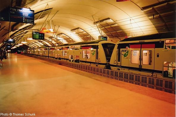
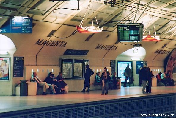
After World War II actually only metro extensions outside the city limits were built (apart from St.Lazare - Invalides). In the 70's and 80's special emphasis was put on the RER System (Regional Express Network) which currently consists of five lines (A, B, C, D, E) crossing the city underground (line C only partly) and connecting formerly existing suburban rail lines. This network is operated jointly by RATP (Métro and buses) and SNCF (French National Railways). The last of these lines, which was formerly referred to as EOLE, now ligne E, opened in July 1999 between St. Lazare and Magenta. On 3 Dec 2000, a new station was opened on Line C at Bibliothèque François Mitterrand to provide transfer to Line 14. This new station replaces the former Masséna station.


Photos © Thomas Schunk
TRAM
Besides its dense metro system and extensive RER network, Paris now has several tram lines which, however, do not form a proper network, but each line operates separately and has its own characteristics, though all share the standard gauge of 1435 mm. Click here for more details.


Books
Christoph Groneck & Robert Schwandl: TRAM ATLAS FRANKREICH / FRANCE. - 03/2014, Robert Schwandl Verlag, ISBN 3 936573 42 8 (More info)
Christoph Groneck: METROS IN FRANKREICH / METROS IN FRANCE. Paris, Lyon, Marseille, Lille, Toulouse, Rennes, Rouen & Laon. - Aug. 2006, Robert Schwandl Verlag, ISBN 3 936573 13 1 (More info)
Mark Ovenden: Paris Metro Style: In Map and Station Design - Nov. 2008, Capital Transport, London, ISBN 978-1854143228 - Great books with hundreds of original maps and loads of photos.
Arnold Delaney: PARIS BY METRO. An Underground History. - 2006, 100 p., Interlink Publishing Group, ISBN 1566566460 - explains origin of all station names with several colour photos
Larry Yust: METRO. - Oct. 2004. 136 p., Gingko Press, ISBN: 1584231742 Spectacular photos of Paris metro stations

F. Descouturelle, A. Mignard, M. Rodriguez: Le Métropolitain d'Hector Guimard . - Oct. 2003, 152 p., Somogy, ISBN 2850566691
Jean-Pierre Rigouard: Le Métro de Paris. Tome 2: Les lignes complémentaires (Lignes 7 - 13). - Feb. 2003, 128 pages, Alan Sutton; Collection : memoire en images, ISBN 2842538471 (Also available here)
Jean-Pierre Rigouard: Le Métro de Paris. Tome 1: Les premières lignes.- 2002, 128 pages, Alan Sutton ISBN 2842537777 (Also available here)
Gaston Jacobs: Le métro de Paris. Un siècle de matériel roulant. - 2001, 223p. La Vie du rail , ISBN 2902808976
Gérard Rolland: Stations de métro Le dictionnaire des 366 stations. - Christine Bonneton Éditeur, Paris, 2003 (new edition). - Explains origin of station names.
Jean-Paul Carminati: Dictionnaire imaginaire des stations de métro
Clive Lamming: Paris Ferroviaire. - 2002, Parigramme, ISBN 2840962926
Clive Lamming: Paris Tram. - 2003, Parigramme, ISBN 2840961962
Jean Orselli: Les nouveaux tramways: Comment ne pas rater son tram. - 2004, Paradigme, Collection: Transports et communication, 268 p., ISBN 2868782388
Christoph Groneck: Neue Straßenbahnen in Frankreich. - 2003, 167p., Ek-Verlag, ISBN 388255844X
Plotkin, Susan L.: The Paris Metro - A Ticket to French History. - ISBN 0738852473, April 2001 (US orders)
Roland, Gérard: PARIS METRO RETRO - C. Bonneton, 2001. ISBN 2862532797
This small book (pocket sized, printed on glossy paper) is a story of the Metro at the beginning of the 20th century through old postcards (building, trains, stations, ...) with comments by the author.
Hardy, Brian: PARIS METRO HANDBOOK. - Capital Transport, new 1999 edition.
Lamming, Clive: MÉTRO INSOLITE. - Parigramme, Paris, 176 p., many photos (March 2001). ISBN 2840961903
Various: Le kiosque des noctambules, une oeuvre de Jean Michel Othoniel.
- Flohic, Dec. 2000, ISBN 2842341082, 80 pages - It' s the story of the new metro entrance called "Le Kiosque des Noctambules" at station Palais-Royal.
Chansons Metropolitains. (CD) - 48 songs from 1900-2000 related with the Métro (leaflet included). Feb. 2001
Jean Tricoire: Un Siècle de Métro en 14 Lignes - Best book on Paris Metro
Jean Tricoire: Le métro de Paris: 1899-1911 : images de la construction
Game/Michaud: Métro histoires illustrees des stations
Je travaillais dans le métro...
Satoshi Kako: Les travaux du métro
Sheila Hallsted-Baumert, a.o.: Métro-cité : le chemin de fer métropolitain à la conquête de Paris, 1871-1945
Jean-Claude Demory: Le métro de chez nous
Le métro a cent ans - agenda 2000
Berton, Claude and Alexandre Ossadzow: FULGENCE BIENVENÜE et la construction du Métropolitain de Paris. - Presses de l'école nationale des Ponts et chaussées, Paris, 1998.
Bruno Latour: ARAMIS ou l'amour des techniques. - La Decouverte (Textes a l App); ISBN 2707121207. Explains a former MATRA project of a small automatic metro tested in Paris in the 1980's.
Richard Whittaker's Métro Experience with many photos
Official RATP site
Paris Metro Extension Projects
Transilien - SNCF Suburban Rail in Ile-de-France
STIF - Syndicat des Transports Ile-de-France
AMATUIR.org (Association pour le Musée des Transports Urbains, Interurbains et Ruraux) incl. large metrpo history section
Ligne Rouge Sud (Project Website) - first section of a planned 100 km orbital line
Ligne 14 North Extension
Paris Metro at Wikipedia and Wikipedia.fr
SymBioz - Transport en Commun à Paris
Carto.metro - Fantastic track maps, for Métro, RER and Tram
A Railfan's Guide to the Paris Métro by David Pierman
Closed Metro stations in Paris
Paris Metro Pictures on Railfan Europe
Le site perso du Métro
Metrorama Photos panoramiques du métro de Paris
PlanètePixel - incl. great panoramic metro station photos
UrbanRail.Net - full Paris Métro map (1770 x 1700 pixels, 116 K)
All Guimard station entrances at Paris Inconnu
MetroNexCo: Collection of historic Paris Metro Maps by Peter B. Lloyd
Trams in Paris by Christoph Groneck
urbanrail.net
13/12/1900: Porte Dauphine – Charles de Gaulle Etoile
10/1902: Charles de Gaulle Etoile – Anvers
31/01/1903: Anvers – Rue de Bagnolet (since 1970 Alexandre Dumas)
02/04/1903: Rue de Bagnolet (Alexandre Dumas) – Nation
More Line 2 photos
(12 km):
10/10/1904: Père Lachaise - Villiers
01/1905 Père Lachaise - Gambetta
05/1910: Villiers - Péreire
02/1911: Péreire - Pte. Champerret
09/1937: Pte. Champerret - Pont de Levallois/Bécon
02/04/1971: Gambetta - Gallieni
More Line 3 photos
(1.3 km):
27/11/1921: Gambetta - Porte des Lilas (originally part of line 3, since 1971 separate)
More Line 3b photos
(11.3 km):
21/04/1908: Porte de Clignancourt – Châtelet
30/10/1909: Porte d'Orleans – Raspail
09/01/1910 Châtelet - Raspail 23/03/2013: Porte d'Orleans - Mairie de Montrouge (0.8 km)
Les Halles station reconstructed and reopened on 03/10/1977 with new RER station.
After the first section of the southern extension from Porte d'Orléans to Mairie de Montrouge was brought into service in March 2013, line 4 will be extended further south, 2014-2019, with two stations, Verdun-Sud and Bagneux (1.9 km).
Montrouge extension: Project blog | Bagneux extension: Project Website
More Line 4 photos
(14.5 km):
02/06/1906: Place d'Italie – Gare d’Orléans (now Gare d’Austerlitz)
07/1906: Gare d’Austerlitz - Place Mazas (now Quai de la Rapée)
12/1906: Quai de la Rapée - Lancry (now Jacques Bonsergent)
15/11/1907: Jacques Bonsergent - Gare du Nord
10/1942: Gare du Nord - Église de Pantin
25/04/1985: Église de Pantin - Bobigny/Pablo Picasso
More Line 5 photos
(southern ring line) (13.5 km), until 14/10/1907 called ligne 2 Sud; then until 1942 Étoile - Pl. d'Italie section was a part of line 5; Pl. d’Italie – Nation was a ligne 6:
02/10/1900: Étoile - Trocadéro
11/1903: Trocadéro - Passy
04/1906: Passy - Place d'Italie
03/1909: Place d'Italie - Nation
At Étoile - Charles de Gaulle trains reverse in a loop, there is also such a loop at Nation which is only used during rush hours.
More Line 6 photos
(22.5 km)
05/11/1910: Porte de la Villette – Opéra
07/1916: Opéra - Palais Royal
04/1926: Palais Royal - Pont-Marie
02/1930: (Odéon (L10) -) Place Monge – Place d’Italie
03/1930: Place d’Italie - Porte de Choisy
06/1930: Pont-Marie - Pont Sully (now Sully Morland)
26/04/1931: Sully Morland - Place Monge - Porte d'Ivry
01/05/1945 Porte d'Ivry - Mairie d'Ivry
10/1979 Porte de la Villette - Fort d'Aubervilliers
12/1982: Maison Blanche - Le Kremlin-Bicêtre
02/1985: Le Kremlin-Bicêtre - Villejuif-Louis Aragon
06/05/1987: Fort d'Aubervilliers - La Courneuve
Pierre Curie station renamed Pierre et Marie Curie on 8 Mar 2007.
More Line 7 photos
(3 km):
18/01/1911: Pré-St.Gervais - Louis Blanc (line 7 branch, separate line since 1967)
More Line 7b photos
(23.3 km):
13/07/1913: (Charles Michels on today's Line 10) - La Motte Picquet Grenelle - Opéra
06/1928: Opéra - Richelieu-Drouot
05/1931: Richelieu-Drouot - Porte de Charenton
07/1937: La Motte Picquet Grenelle - Balard
10/1942: Porte de Charenton - Charenton-Écoles
09/1970: Charenton-Écoles – Maisons-Alfort Stade
04/1972: Maisons-Alfort Stade - Maisons-Alfort Les Juilliottes
09/1973: Maisons-Alfort Les Juilliottes - Créteil-l’Échat
10/09/1974: Créteil-l’Échat - Créteil-Préfecture08/10/2011: Créteil-Préfecture - Créteil-Pointe du Lac
At Commerce platforms are not opposite each other, but staggered.
More Line 8 photos
(20 km):
08/11/1922: Exelmans - Trocadéro
05/1923: Trocadéro - Saint-Augustin
06/1923: Saint-Augustin - Chaussée d'Antin
09/1923: Exelmans – Porte de Saint-Cloud
06/1928: Chaussée d'Antin - Richelieu-Drouot
12/1933: Richelieu-Drouot - Porte de Montreuil
02/1934: Porte de Saint-Cloud - Pont de Sèvres
10/1937: Porte de Montreuil - Mairie de Montreuil
More Line 9 photos
(12 km):
13/07/1913: La Motte Picquet Grenelle – Beaugrenelle (now Charles Michels) (as a branch of Ligne 8)
09/1913: Charles Michels - Porte d'Auteuil
12/1923: (Invalides - Duroc) - Croix Rouge (closed after WWII)
03/1925: Duroc - Mabillon
02/1926: Mabillon - Odéon
02/1930: Odéon - Maubert Mutualité (- Pl. d’Italie, from Place de Monge using the tracks of today's Ligne 7);
04/1931: Maubert Mutualité - Jussieu
07/1937: La Motte Picquet Grenelle - Duroc
07/1939: Jussieu - Gare d'Austerlitz
10/1980: Porte d'Auteuil - Boulogne Jean Jaurès
02/10/1981: Boulogne Jean Jaurès - Boulogne Pont de St.Cloud
More Line 10 photos
(6.5 km):
28/04/1935: Châtelet – Porte des Lilas
17/02/1937: Porte des Lilas - Mairie des Lilas
Line 11 will be extended from Mairie des Lilas to Rosny-Bois-Perrier via Noisy-le-Sec and Romainville (6 stations, one of which elevated). Construction 2015 - 2020. [Project Website] In a later stage, another extension, part of the Grand Paris project, will follow from Rosny-Bois Perrier to Noisy - Champ where it will meet the future lines 15 and 16.
More Line 11 photos
(15.2 km):
05/11/1910: Porte de Versailles – Notre-Dame-de-Lorette
04/1911: Notre-Dame-de-Lorette - Pigalle
10/1912: Pigalle - Jules-Joffrin
08/1916: Jules-Joffrin - Porte de la Chapelle
24/03/1934: Porte de Versailles - Mairie d'Issy
18/12/2012: Porte de la Chapelle - Aubervilliers Front Populaire Line 12 is being extended further north from Aubervilliers Front Populaire to Mairie d'Aubervilliers via Aimé Césaire (2 km, 2017).
Project Website
More Line 12 photos
(23 km):
26/02/1911: Saint-Lazare - Porte de Saint-Ouen
01/1912: La Fourche - Porte de Clichy
12/1923 Invalides - Duroc (formerly a part of a line 10; then line 14)
01/1937: Montparnasse-Bienvenüe - Porte de Vanves
07/1937: Montparnasse-Bienvenüe - Duroc
06/1952: Porte de Saint-Ouen - Carrefour Pleyel
06/1973: Saint-Lazare - Miromesnil
02/1975: Miromesnil - Champs-Elysées Clémenceau
05/1976: Carrefour Pleyel - Saint-Denis-Basilique
11/1976: Champs-Elysées Clémenceau - Invalides (connection with ex-line 14) and Porte de Vanves - Châtillon-Montrouge
05/1980: Porte de Clichy - Gabriel Péri
25/05/1998: Saint-Denis-Basilique - Saint-Denis Université14/06/2008: Gabriel Péri - Asnières-Gennevilliers Les Courtilles (1.9 km)
At Liège platforms are not opposite each other, and at La Fourche the trains coming from St.Denis stop on the lower level.
More Line 13 photos
Line 13 was planned to be further extended from Asnières-Gennevilliers Les Courtilles to Port de Gennevilliers.
(9 km)
Finally in the 1990's Paris started to build a new metro line, the so-called METEOR (Métro Est Ouest Rapide) although from the day of inauguration (15/Oct/1998) it is called ligne 14. This line is meant to alleviate ligne 1 and RER ligne A in the central area and starts at Maison Blanche in the south, then runs parallel to ligne 1 and A between Gare de Lyon and Châtelet-les Halles and finally turns north to St. Lazare from where it will be connected to the western branch (Gabriel Péri) of ligne 13. After some years of delay the first stretch from Bibliothèque F. Mitterrand (planned as Tolbiac-Masséna) to Madeleine was finally opened in October 1998. In summer 1998 construction work for the second section to St. Lazare started, which was finished in Dec. 2003. In autumn 2000, construction of a small workshop began, which was necessary to rebuild the original workshop into Olympiades station that was finally completed in June 2007.
15/10/1998: Madeleine - Bibliothèque François Mitterrand
16/12/2003: Madeleine - Saint-Lazare26/06/2007: Bibliothèque François Mitterrand - Olympiades
More Line 14 photos
Initially planned to be extended north to Place de Clichy and La Fourche and connected to one of the northern branches of ligne 13, ligne 14 will now be extended to Mairie de Saint-Ouen (RER C) via Porte de Clichy (Ligne 13). More details here
Initially planned to be extended south to Maison Blanche, M7, with a connection to the Villejuif branch of line 7, it is now planned to be extended south to Orly Airport on a new, more westerly route as part of the Nouveau Grand Paris network (which includes lines 15-18, see below).
Other Metro Projects
Besides the extensions planned to existing lines (notably, lines 4, 11, 12 and 14), the Grand Paris Express network is planned, a system of circular and tangential metro lines around Paris proper:
Line 15 - a sort of orbital line with a handle in the east, with the first section between Pont de Sèvres (M9) to Noisy Champs to be built first by 2020. Later, a western extension will continue to La Défense an the new hub at Saint-Denis Pleyel near the current RER station on line D. The eastern leg of this line will parallel the existing RER E route between Rosny-Bois-Perrier and Nogent Le Perreux and terminate at Champigny, where interchange would be available to the initial section of line 15.
Line 16 - from Saint-Denis Pleyel to Noisy Champs via Sevran Beaudottes and Sevran Livry, both on RER line B. (Project Website)
Line 17 - will also start at Saint-Denis Pleyel and share tracks with line 16 up to Le Bourget before heading northeast towards Charles-de-Gaulle Airport and eventually to Le Mesnil Amelot.
Line 18 - less defined, it would serve the southwestern outskirts between Versailles and Orly.
Details and progress of all these projects can be found on the STIF website and also at Societé du Grand Paris!
RER
After World War II actually only metro extensions outside the city limits were built (apart from St.Lazare - Invalides). In the 70's and 80's special emphasis was put on the RER System (Regional Express Network) which currently consists of five lines (A, B, C, D, E) crossing the city underground (line C only partly) and connecting formerly existing suburban rail lines. This network is operated jointly by RATP (Métro and buses) and SNCF (French National Railways). The last of these lines, which was formerly referred to as EOLE, now ligne E, opened in July 1999 between St. Lazare and Magenta. On 3 Dec 2000, a new station was opened on Line C at Bibliothèque François Mitterrand to provide transfer to Line 14. This new station replaces the former Masséna station.

Photos © Thomas Schunk
TRAM
Besides its dense metro system and extensive RER network, Paris now has several tram lines which, however, do not form a proper network, but each line operates separately and has its own characteristics, though all share the standard gauge of 1435 mm. Click here for more details.
Books
Christoph Groneck & Robert Schwandl: TRAM ATLAS FRANKREICH / FRANCE. - 03/2014, Robert Schwandl Verlag, ISBN 3 936573 42 8 (More info)
Christoph Groneck: METROS IN FRANKREICH / METROS IN FRANCE. Paris, Lyon, Marseille, Lille, Toulouse, Rennes, Rouen & Laon. - Aug. 2006, Robert Schwandl Verlag, ISBN 3 936573 13 1 (More info)
Mark Ovenden: Paris Metro Style: In Map and Station Design
- Nov. 2008, Capital Transport, London, ISBN 978-1854143228 - Great books with hundreds of original maps and loads of photos.Arnold Delaney: PARIS BY METRO. An Underground History. - 2006, 100 p., Interlink Publishing Group, ISBN 1566566460 - explains origin of all station names with several colour photos
Larry Yust: METRO. - Oct. 2004. 136 p., Gingko Press, ISBN: 1584231742 Spectacular photos of Paris metro stations
F. Descouturelle, A. Mignard, M. Rodriguez: Le Métropolitain d'Hector Guimard . - Oct. 2003, 152 p., Somogy, ISBN 2850566691
Jean-Pierre Rigouard: Le Métro de Paris. Tome 2: Les lignes complémentaires (Lignes 7 - 13). - Feb. 2003, 128 pages, Alan Sutton; Collection : memoire en images, ISBN 2842538471 (Also available here)
Jean-Pierre Rigouard: Le Métro de Paris. Tome 1: Les premières lignes.- 2002, 128 pages, Alan Sutton ISBN 2842537777 (Also available here)
Gaston Jacobs: Le métro de Paris. Un siècle de matériel roulant. - 2001, 223p. La Vie du rail , ISBN 2902808976
Gérard Rolland: Stations de métro Le dictionnaire des 366 stations. - Christine Bonneton Éditeur, Paris, 2003 (new edition). - Explains origin of station names.
Jean-Paul Carminati: Dictionnaire imaginaire des stations de métro
Clive Lamming: Paris Ferroviaire. - 2002, Parigramme, ISBN 2840962926
Clive Lamming: Paris Tram. - 2003, Parigramme, ISBN 2840961962
Jean Orselli: Les nouveaux tramways: Comment ne pas rater son tram. - 2004, Paradigme, Collection: Transports et communication, 268 p., ISBN 2868782388
Christoph Groneck: Neue Straßenbahnen in Frankreich. - 2003, 167p., Ek-Verlag, ISBN 388255844X
Plotkin, Susan L.: The Paris Metro - A Ticket to French History. - ISBN 0738852473, April 2001 (US orders)
Roland, Gérard: PARIS METRO RETRO - C. Bonneton, 2001. ISBN 2862532797
This small book (pocket sized, printed on glossy paper) is a story of the Metro at the beginning of the 20th century through old postcards (building, trains, stations, ...) with comments by the author.
Hardy, Brian: PARIS METRO HANDBOOK. - Capital Transport, new 1999 edition.
Lamming, Clive: MÉTRO INSOLITE. - Parigramme, Paris, 176 p., many photos (March 2001). ISBN 2840961903
Various: Le kiosque des noctambules, une oeuvre de Jean Michel Othoniel.
- Flohic, Dec. 2000, ISBN 2842341082, 80 pages - It' s the story of the new metro entrance called "Le Kiosque des Noctambules" at station Palais-Royal.
Chansons Metropolitains. (CD) - 48 songs from 1900-2000 related with the Métro (leaflet included). Feb. 2001
Jean Tricoire: Un Siècle de Métro en 14 Lignes - Best book on Paris Metro
Jean Tricoire: Le métro de Paris: 1899-1911 : images de la construction
Game/Michaud: Métro histoires illustrees des stations
Je travaillais dans le métro...
Satoshi Kako: Les travaux du métro
Sheila Hallsted-Baumert, a.o.: Métro-cité : le chemin de fer métropolitain à la conquête de Paris, 1871-1945
Jean-Claude Demory: Le métro de chez nous
Le métro a cent ans - agenda 2000
Berton, Claude and Alexandre Ossadzow: FULGENCE BIENVENÜE et la construction du Métropolitain de Paris. - Presses de l'école nationale des Ponts et chaussées, Paris, 1998.
Bruno Latour: ARAMIS ou l'amour des techniques. - La Decouverte (Textes a l App); ISBN 2707121207. Explains a former MATRA project of a small automatic metro tested in Paris in the 1980's.
Richard Whittaker's Métro Experience with many photos
Official RATP site
Paris Metro Extension Projects
Transilien - SNCF Suburban Rail in Ile-de-France
STIF - Syndicat des Transports Ile-de-France
AMATUIR.org (Association pour le Musée des Transports Urbains, Interurbains et Ruraux) incl. large metrpo history section
Ligne Rouge Sud (Project Website) - first section of a planned 100 km orbital line
Ligne 14 North Extension
Paris Metro at Wikipedia and Wikipedia.fr
SymBioz - Transport en Commun à Paris
Carto.metro - Fantastic track maps, for Métro, RER and Tram
A Railfan's Guide to the Paris Métro by David Pierman
Closed Metro stations in Paris
Paris Metro Pictures on Railfan Europe
Le site perso du Métro
Metrorama Photos panoramiques du métro de Paris
PlanètePixel - incl. great panoramic metro station photos
UrbanRail.Net - full Paris Métro map (1770 x 1700 pixels, 116 K)
All Guimard station entrances at Paris Inconnu
MetroNexCo: Collection of historic Paris Metro Maps by Peter B. Lloyd
Trams in Paris by Christoph Groneck
urbanrail.net